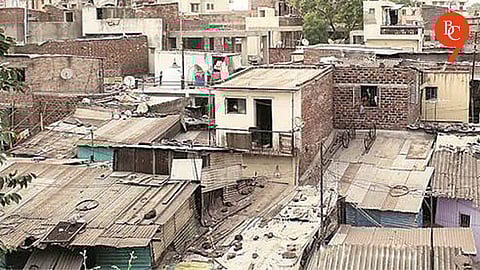

Pune, 20th May 2026: The GIS mapping and biometric surveys of slums in Pune and Pimpri-Chinchwad has been planned by Slum Rehabilitation Authority (SRA) to create a detailed and accurate database of slum areas and residents. Officials believe the initiative will help speed up rehabilitation projects and improve urban planning in both cities.
Currently, Pune and Pimpri-Chinchwad together have 557 slums. However, after the inclusion of 34 villages within municipal limits, the jurisdiction of the SRA has expanded significantly. The authority has launched the exercise to determine the exact number, boundaries, and details of slums in the newly expanded areas.
As part of the project, slums will be mapped through drone-based 3D technology. Each hutment will be assigned a unique identification number, while residents’ photographs and biometric details will also be collected. Authorities will verify documents and prepare a digital database of slum dwellers and properties to avoid discrepancies during rehabilitation work.
The GIS mapping work will be carried out by the government’s MR-SAC agency, while the tender process for the biometric survey is currently underway. The citywide initiative follows the successful implementation of a pilot project in Laxminagar.
“The GIS mapping and biometric survey of slums in Pune and Pimpri-Chinchwad will provide accurate information about slum residents and the actual extent of slum areas. The data collected through this exercise will help in better planning and smoother implementation of future rehabilitation projects,” said Satish Khadke, Chief Officer of the Slum Rehabilitation Authority.

